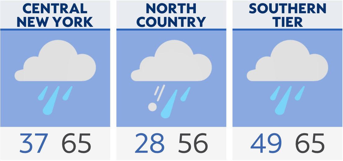
With a frontal boundary draped across Central New York, temperatures will vary greatly from north to south tonight.
Showers are likely through tonight with areas of sleet and freezing rain. The steadiest icy mix will be across the North Country and northern Adirondacks.
Rain continues through much of Sunday as temperatures turn milder. Highs will be back in the 50s and 60s. Watch for slick travel in the morning.
We'll see a few showers and a thunderstorm in spots Monday as highs reach the 60s and 70s. Colder air moves in for Tuesday.
Watch live | Share your weather photos | Hourly forecast and latest radar | Active weather alerts | Closings and delays