
Changing leaves, drying crops... the summer-to-fall transition happens not just before our eyes, but from satellites' "eyes," too.
Let's take a tour of a few of the landscapes of the United States and how much they change over just a few short months.
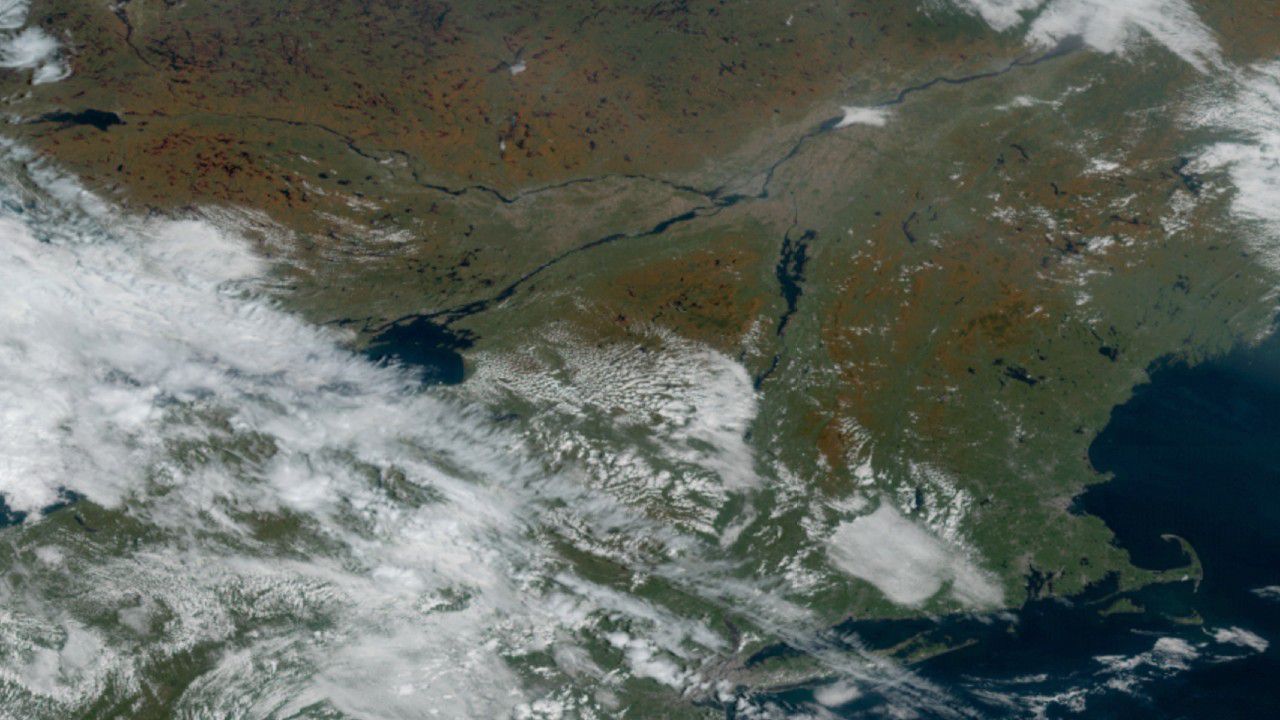
During the summer, the lush forests of the Northeast appear as a deep green from space. Even from 22,000 miles above the ground, though, you can make out the largest cities. The expanse of urban gray contrasts against the green.
In the fall, the densely forested regions turn orange. Despite the passing clouds on Oct. 12, you can still make out the fall foliage across much of New York State and into New England and southern Canada.
The leaf color on that date also shows the topography. Leaves were really changing in the higher elevations, while lower elevations still had a dull green.
The Midwest was just as green in late July, but it wasn't all trees. All the acres of mature crops–mostly corn and soybeans–look similar to the forested areas that cover more of Minnesota and Wisconsin. Smaller cities and even highways crisscrossing the land stand out against the cropland.
The milky color is a haze of wildfire smoke from the western U.S.
Jumping forward to mid-October, the crops dry up as harvest season begins. Instead of a huge area of green, satellite images show a much browner view. You can also pick out where the forested areas are, even along the river valleys that snake across the land. The autumn leaf colors in the denser forests aren't as apparent as they were in the Northeast, though.
Farther south, the Appalachians light up with color. Check out the big swaths of brownish-orange that appear in the higher elevations of western North Carolina, Virginia and West Virginia.
In the rest of the Southeast, the land loses some of its deep green from summer to fall, too. But here, let's focus on the weather, not the land.
In the summer, scattered thunderstorms erupt almost daily. It's especially common on the Florida Peninsula, where the ground warms up and the somewhat cooler air from the ocean moves inland, creating sea breezes.
These miniature cold fronts are the focus for storms that gobble up the stifling humidity and drop localized downpours, and you can see one of them paralleling Florida's eastern coast from the July 29 snapshot with storms blowing up to its west.
Heading into fall, the air starts to dry out a bit as real cold fronts plow in. Instead of clusters of storms flaring up, batches of friendly fair-weather clouds develop. If a cold front is strong enough, it can scour away enough moisture to keep many clouds from forming at all.
While most people believe meteorologists use satellites to only track weather systems, they're also great for seeing how the land changes over weeks and months. We'll see stark changes again as winter's snow and ice return.