
With triple-digit heat, droughts and slow-moving hurricanes that dump rain measured in feet, not inches, the people of North Carolina are not strangers to climate extremes. But central North Carolina faces growing risks from climate disasters, according to new draft reports.
The pair of draft reports released this week detail the findings from the North Carolina Office of Recovery and Resiliency on seven counties in North Carolina.
“The communities located within the Mid-Carolina region, like much of eastern and central North Carolina, are exposed and remain vulnerable to a variety of natural hazards, such as hurricanes, flooding, heat waves and other extreme weather events. The frequency and magnitude of natural hazards are expected to increase as the climate warms,” one of the reports states.
The Mid-Carolina Council of Governments Region includes Cumberland, Harnett and Sampson counties and is the focus of one report. The other studies the risks in Chatham, Johnston, Lee and Moore counties, called the Triangle J Council of Governments Region.
The reports look at the major climate hazards in central North Carolina and how vulnerable the population is. The idea is to use the reports to set priorities so communities can prepare better for natural disasters, which will become more common with climate change, the reports say.
Climate change, one report states, “shifting the profile of risk and vulnerability in the region, and it is critical to understand how the future may look different from the past. Anticipating these impacts helps to build a region’s resilience to climate change and natural hazards.”
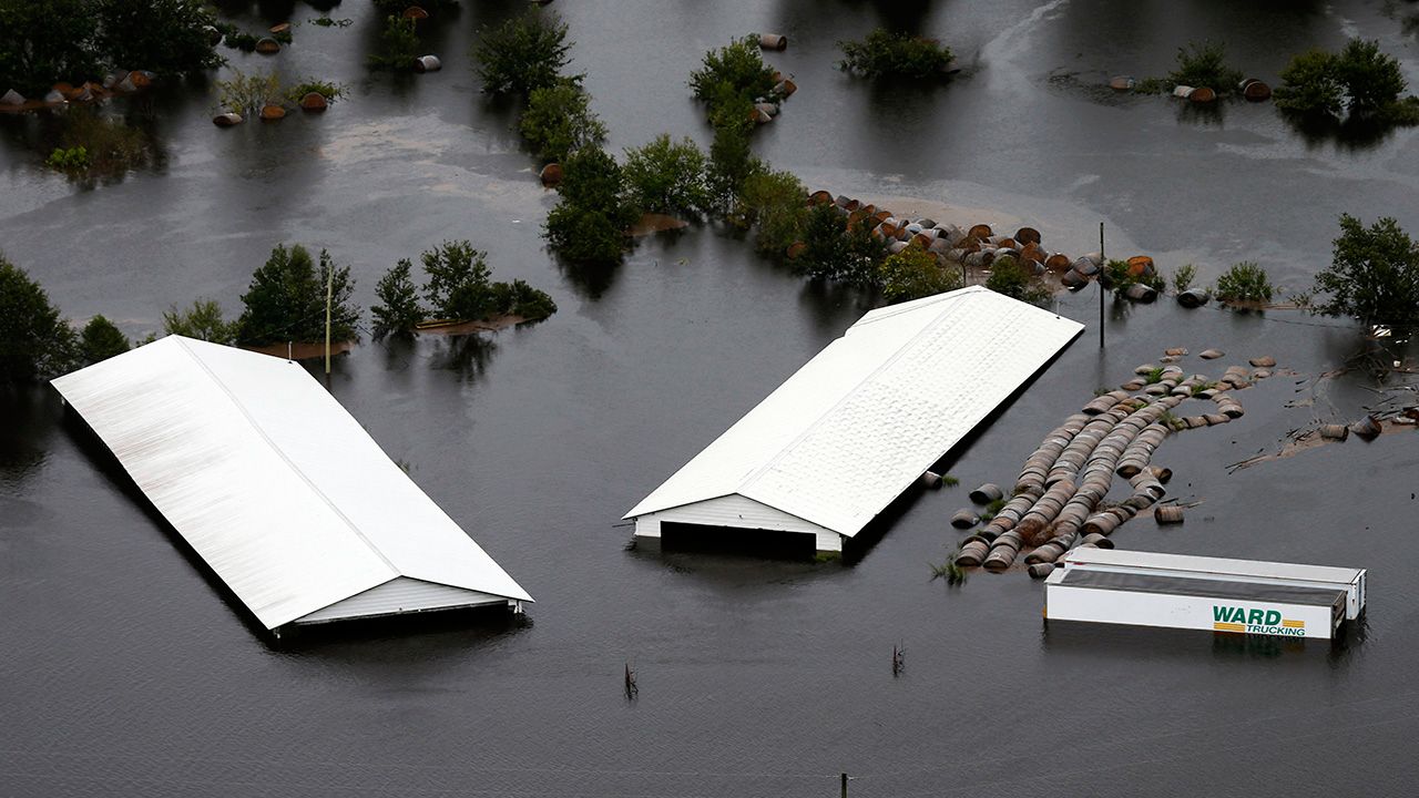
Communities in the Mid-Carolina region, including around Fayetteville, Dunn and Clinton, know all too well what severe flooding can do to their communities. Both hurricanes Matthew and Florence flooded homes and roads, cutting off emergency access to some areas.
“The movement of emergency response personnel was severely impaired when more than 1,760 roads were closed during the Hurricane Matthew event and more than 2,500 roads were shut down during Florence,” according to the report.
Drought and wildfires are also a concern for residents in the three-county region, a state survey found.
“Human-led growth in the wildland-urban interface is particularly susceptible to wildfires. As development expands into rural and forested areas, critical infrastructure and facilities are at greater risk of wildfire and associated damages,” the report says.
According to the report, there are almost 90,000 buildings at high risk of wildfire between Cumberland, Harnett and Sampson counties, with a value of almost $25 billion.
The Triangle J region includes two of North Carolina’s fastest growing counties: Johnston and Chatham. Both grew by about 28% between 2010 and 2020, the report states.
Hurricanes and tropical storms are not as much of a concern this far inland. But the effects of hurricanes Matthew and Florence still caused problems for people in the region, especially in Johnston County.
Hurricane Matthew closed Johnston County schools for a week, according to the report. A hospital had to bring in potable water. A wastewater treatment plant in Smithfield flooded and released 50-million gallons of untreated water into nearby creeks and streams.
Heat is another problem the report warns will get worse.
“Although the Triangle J Region is not yet experiencing an overall increase in frequency of very hot days—characterized as having a maximum temperature of 95°F or higher, the number of very warm nights—nights with a minimum temperature of 75°F or higher—have been on an upward trajectory since the 1970s,” the report states.
“Prolonged periods of hot weather, known as heat waves, can lead to illness and death, particularly among older adults, the very young and other vulnerable populations,” according to the report. “As the Earth’s climate warms overall, heat waves are expected to become more frequent and intense, increasing the need to heighten resilience against heat-related natural hazards.”
The report identifies areas that are the most vulnerable in each county. Researchers used data to identify areas that are prone to flooding, where people generally have lower income and a higher percentage of the population can’t speak English. The report looks at what’s called “social vulnerability” in communities.
The hope is that cities and counties will use these reports and the data to help direct spending and make communities more resilient. That could mean making streets less flood-prone, moving emergency resources away from flood zones.
The state is taking comments on the “Climate Change and Natural Hazards Vulnerability Assessments” before finalizing the reports.