
Gov. Roy Cooper declared a state of emergency Wednesday afternoon ahead of Ian, which is expected to slam the state with wind and rain this weekend after punching Florida with the fury of a Category 4 storm.
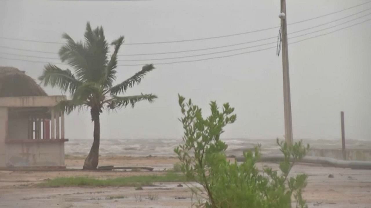
Ian made landfall as a hurricane Wednesday afternoon near Fort Myers, Florida with maximum winds of 150 mph. It has since weakened to a tropical storm.
Ian will track into the Atlantic Thursday and could make a second landfall as a strong tropical storm or category 1 hurricane along the South Carolina coast Friday.
“A State of Emergency is needed now so that farmers and those preparing for the storm can more quickly get ready for the heavy rain that is likely to fall in much of our state,” Cooper said in a news release Wednesday. “North Carolinians should stay aware, keep a close eye on the forecast and prepare their emergency supplies.”
The storm is expected to move northward through the Tar Heel state Saturday. Wednesday afternoon, ahead of the storm, several N.C. coastal area schools switched to remote learning.
Most of the state is forecast to get 2 to 5 inches of rain late this week and into the weekend, but other areas could see even more. The coast and mountains could get 5 to 7 inches of rain. Western North Carolina may also see landslides. Localized flooding, gusty winds and isolated tornadoes are possible, along with the impacts that they can create, like downed trees and power outages.
Ahead of the storm, the governor's state of emergency allows operation plans to get underway and waives certain transportation rules so fuel and other supplies can move to needed areas faster. The emergency mode also helps first responders, farmers and helps shield against price gouging. The governor has also activated 80 National Guard members to help out as needed.
The State Emergency Response Team will operate 24 hours, starting Thursday morning, as well as coordinating with government partners, nonprofits and private sectors to ensure the safety and support through Ian’s impacts.
State officials recommend using various sources for getting emergency information and having an emergency kit ready.
Rain from Ian won’t reach the state until later this week, but some schools are already announcing they’re moving to remote learning. Schools in Bladen, Pender, New Hanover and Brunswick County will be remote Friday. The North Carolina Zoo in Asheboro is also closing ahead of the storm with plans to reopen Sunday.
Ian is bringing catastrophic impacts, including life-threatening storm surge, along with coastal and inland flooding to the Florida peninsula.
As North Carolina braces for impacts from the storm's remnants, the governor and emergency officials offered these tips to help people be prepared:
- Have multiple ways to receive emergency information, including watches and warnings. Make sure emergency alerts are enabled on a cell phone and download a weather app.
- Have an emergency plan. Know where to go if there’s a need to evacuate. Make a plan to stay with family, friends or at a hotel. Public shelters should be a last resort.
- Gather some emergency supplies or refresh an emergency kit. Visit ReadyNC.gov for info on how to build an emergency kit.
- If people live at the coast, be aware if you live in a coastal evacuation zone. Visit KnowYourZone.nc.gov to see if you are located in a pre-determined evacuation zone. Learn your zone and listen for it if evacuations are ordered by local governments.
Get interactive radar and hyperlocal weather alerts on the Spectrum News App.