The 7.1 magnitude earthquake that shook near Ridgecrest, California late last week ripped open a fissure which is visible from space.
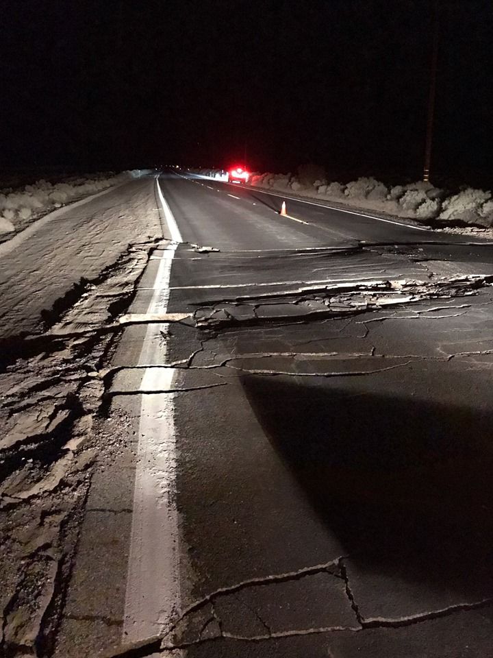
This was the second strong earthquake to hit this area about 150 miles northeast of Las Angeles in less than 48 hours. The immediate damage it caused was very clear. Stores had broken bottles and exploded cans littering their floors and other items that had been hanging on walls had toppled over. As the sun rose the next day, it also became clear that the area’s topography had changed.
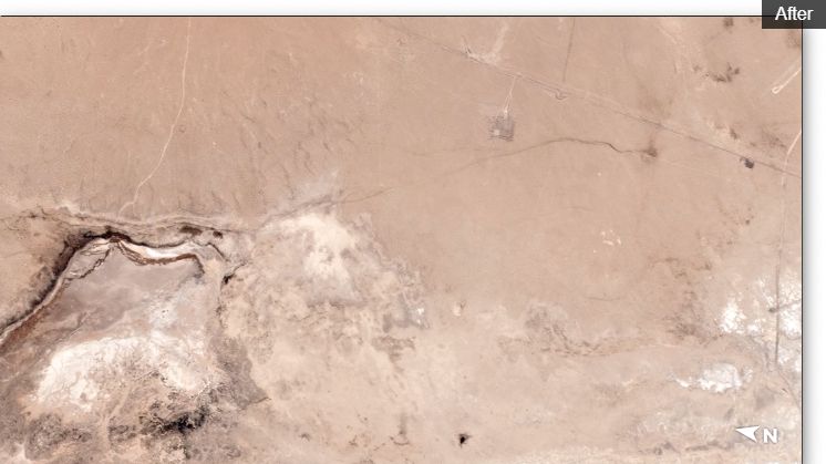
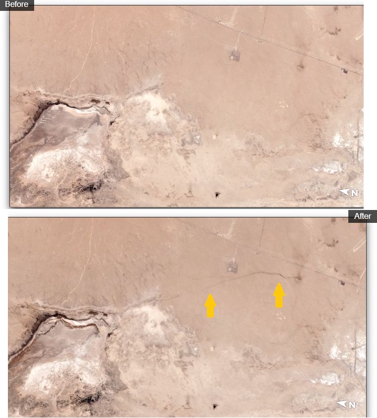
Satellite images provided to CNN by Planet Labs, Inc. show a crack has formed in the area close to the epicenter. The large crack extends some distance from an area that apparently held water before. The erosion patterns on the desert sand indicate that some of that water was sucked out. The satellite image isn’t the only evidence that the region’s topography was changed by the earthquake. A nearby highway is now shutdown after tremors cracked and moved sections of the roadway.