
2020 did not disappoint when it came to the Atlantic hurricane season.
The season managed to shatter almost every record while creating some new ones.
When the season came to a close, it managed to break about 30 records.
Almost every named storm on the list was the earliest to form in recorded history, including the Greek alphabet.
With Arthur and Bertha forming in May, this marked the third time two named storms formed in May.
We dipped into the Greek Alphabet when Beta formed on September 18th, making it the second time in history. We broke yet another record when Wilfred and Alpha formed on the same day: The first time three named storms have formed on the same day.
When we reached Theta, it broke the 2005 record of most named storms in a season, putting 2020 in first place.
We also had the most landfalls this year, coming in at 12.
Through November, the 13 hurricanes remain second all-time, only trailing the 15 that formed in 2005.
With the 30 named storms that formed, there were quite a few that made an impression.
Check out some of the top ones for the season.

Isaias: Originating as a tropical wave that came off the coast of Africa, the large circulation of what would become Isaias took its time in organizing.
On July 29, Isaias formed as a tropical storm south of Puerto Rico in the Caribbean Sea. Becoming the season's second hurricane a day later, the storm passed over the Bahamas before encountering hostile conditions that caused it to weaken back to a tropical storm.
Isaias scraped the east coast of Florida with tropical storm conditions on August 2.
From there, Isaias traveled north, intensifying back into a hurricane. People along the East Coast saw hurricane and tropical storm alerts posted from South Carolina to Maine.
Late on August 3, Isaias made landfall as a Category 1 hurricane with winds of 85 mph at Ocean Isle Beach in North Carolina, about 30 miles northeast of Myrtle Beach, South Carolina.
Strong winds and storm surge damaged homes in nearby Oak Island, NC. Two people lost their lives from an EF3 tornado spawned by Isaias, the strongest tornado from a tropical cyclone in 15 years.
As Isaias accelerated north, impacts spread to the Mid-Atlantic and Northeast.
Isaias was the most impactful wind event in New York City since Sandy struck in 2012. Winds gusted to 78 mph in the city and knocked out power to millions across the Northeast.
The storm continued into Canada before finally meeting its demise.
Laura: A traditional long-track tropical cyclone, Laura originated off the coast of Africa before heading west across the Atlantic. Tracking through the Antilles, the storm gradually grew more organized, dropping heavy rain that caused dozens of fatalities in the process.
As its path turned toward the Gulf of Mexico, concerns grew of a twin impact along the Gulf Coast between and Laura and Tropical Storm Marco, a growing cyclone already in the Gulf.
While Marco was initially forecast to strike Louisiana as a hurricane, thankfully, the storm weakened significantly before making landfall.
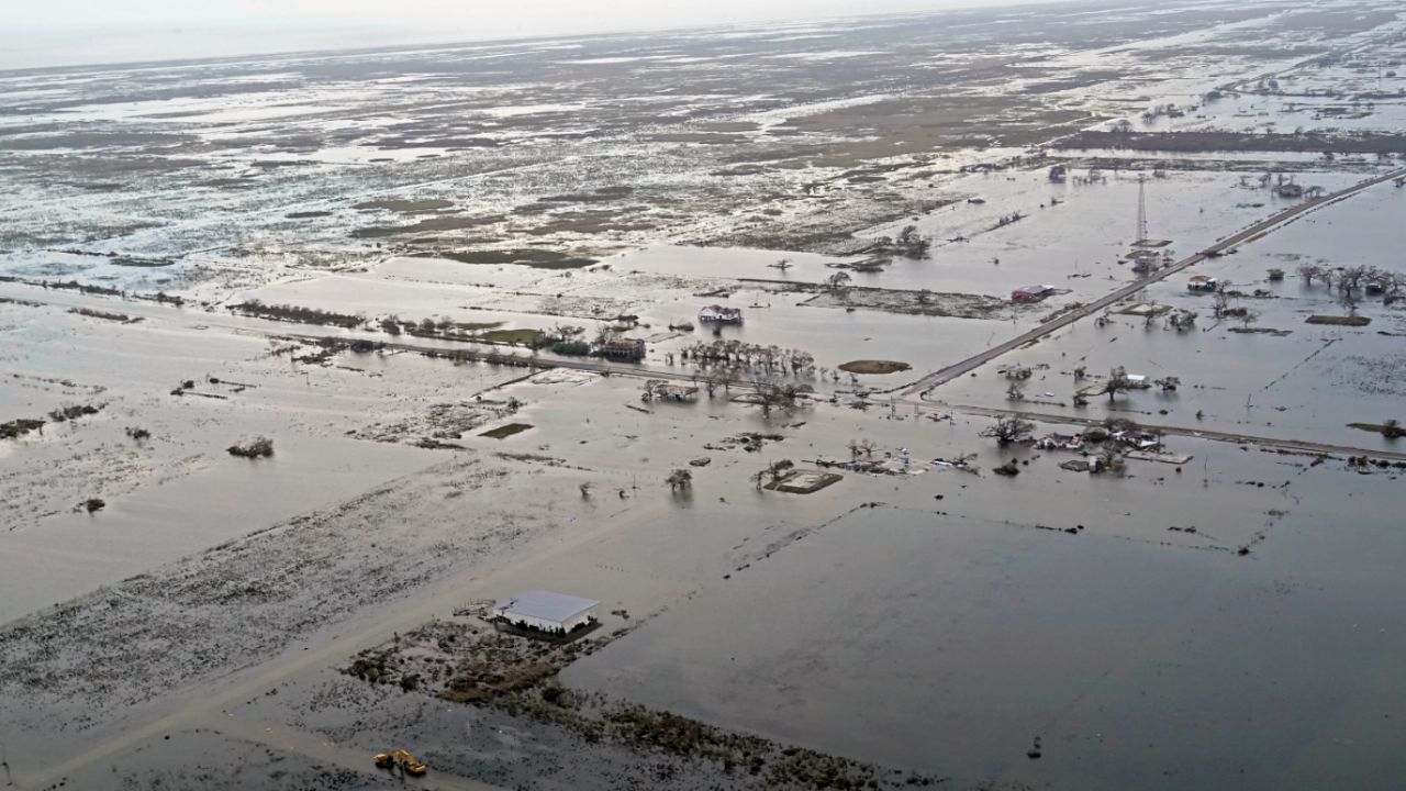
Unfortunately, that wasn't the case for Laura. Taking advantage of ideal conditions for development, Laura rapidly intensified right up until landfall, becoming an extremely dangerous Category 4 hurricane with winds of 150 mph.
Laura made history, tying with a hurricane from the 1850s, as the strongest storm to ever strike the state of Louisiana. Storm surge inundated coastal communities, leading to a train derailment in Grand Lake.
The costliest storm of the season, Laura caused over $14 billion in damages. Sadly, 42 people lost their lives in the United States, primarily in Louisiana and Texas.
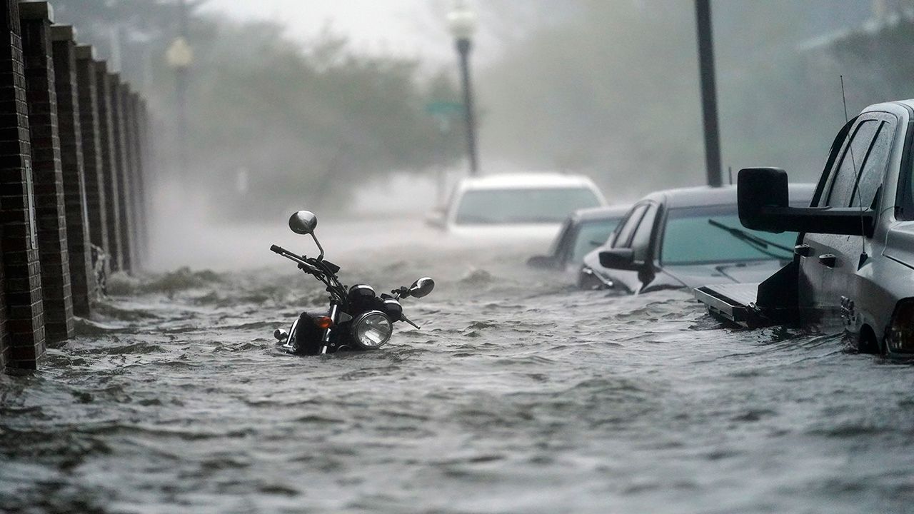
Sally: Sally became the first recorded S-storm to form in September and the fifth storm to hit the northern Gulf Coast.
It first developed as a depression near the Bahamas on September 11 during the peak of the hurricane season, then crossed over Florida as a tropical storm a day later. It underwent rapid intensification and peaked at a Category 2 hurricane in the Gulf of Mexico.
Sally eventually made landfall near Gulf Shores, Alabama on September 15 as a Category 2.
Sally dumped copious amounts of rainfall across the northern and eastern Gulf Coast, with Pensacola, Florida reaching close to 2 feet of rain. Twenty-two barges broke loose in Pensacola Bay due to the rough waves, with several barges washing up in the city.
Because of the high waters, raw sewage contaminated cities like Panama City, Florida, and officials advised people living there to fill their bathtubs with clean water until they could clean up the sewage.
Eta: Eta was persistent, to say the least, lasting around two weeks and making four landfalls. It also became the only Eta on record.
This storm helped us tie with the 2005 season (the NHC retroactively named a storm after the season ended).
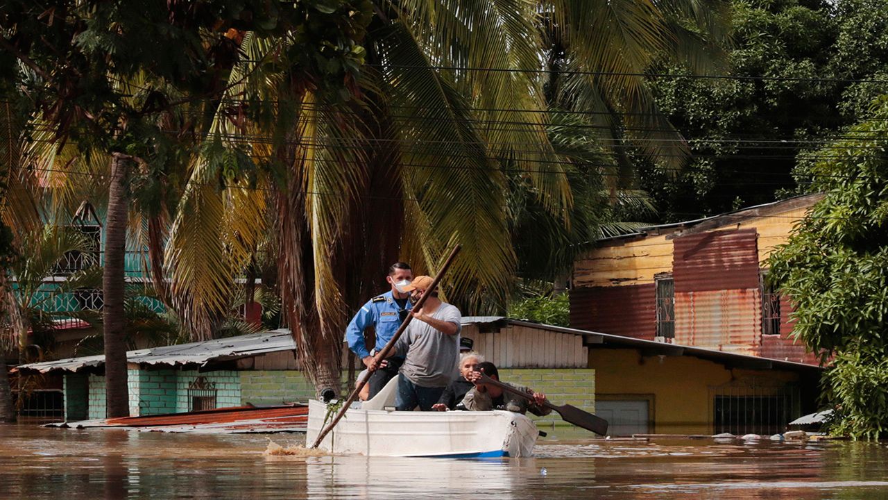
It first formed as a tropical depression on October 31, rapidly intensified, and became a hurricane the next day. Eta continued to intensify, reaching Category 4 status and making landfall in Nicaragua on November 3.
Heavy rainfall led to landslides and many deaths.
Eta weakened and then moved into open waters. It made its second landfall in Cuba on November 9 as a tropical storm, moved into open waters again, made a third landfall in the Keys on the same day, and then stalled in the central Atlantic.
On November 11, it finally pushed north, where it became a Category 1 hurricane, but it weakened to a tropical storm before making landfall near Cedar Key, Florida.
It moved across northern Florida and finally exited into the Atlantic.
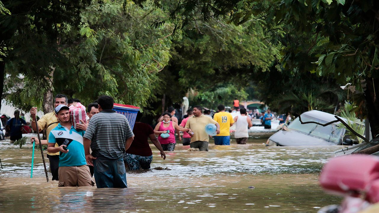
Iota: Iota broke new records, becoming the first Iota on record and becoming the latest Category 5 storm of any season. Iota also set the record for most named storms in an Atlantic hurricane season. Unfortunately, it was also a powerful storm that made landfall in Central America not long after Eta impacted the area.
First becoming a tropical depression on November 13, Iota was not expected to become the powerful storm that it did. It battled with wind shear, but not long after, won the fight and started to quickly intensify.
In the early morning hours on November 16, around 1 a.m., Iota became a major Category 3 hurricane. Only 40 minutes later, it intensified to a Category 4.
Later that morning, Iota reached Category 5 status, marking the second time a Category 5 hurricane has occurred in November. It weakened by that evening to a Category 4 hurricane and made landfall in Nicaragua.
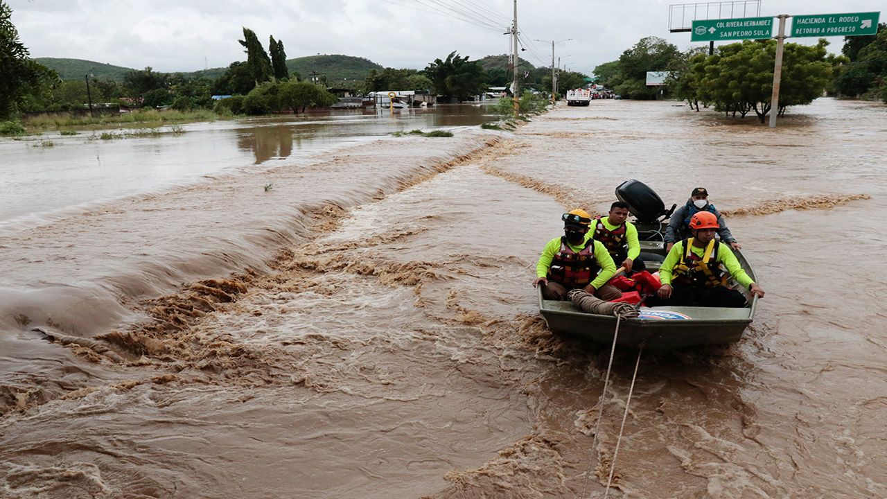
Iota generated very heavy rainfall in an area that was still recovering from Eta. This led to many more landslides and flooding which led to more than 50 deaths, with many more missing. The back-to-back powerful storms left many people homeless.
Even with the 2020 season being one for the books, we have to note the good news with the season.
"It was a record in the number of named storms but not with deaths and damage (in the U.S.). The fatalities and damage were relatively low considering the number of named storms and U.S. Landfalls. Many of the largest and most venerable cities weren’t hit but even NOLA took a direct hit, and the damage was minor. In other words, the U.S. was just lucky" says Spectrum News Chief Meteorologist Mike Clay, who is based in Tampa.
Fortunately, the U.S. didn't see devastating impacts all season long, but could the 2020 season predict future hurricane seasons? Meteorologist Chris Bianchi breaks it down a little more.
Even though the future is a little hazy, we know one thing for sure. Always have your hurricane kit ready to go, and be prepared well before your area is impacted by a storm.
Tomorrow, we’ll reveal our full list of the top-five weather stories from 2020. In the meantime, here’s a look at the second-biggest story from 2020: The West's record-setting wildfires and drought.