
In a new report, federal officials say they’re more confident than ever that sea levels off the U.S. coast will rise about a foot in the next 30 years — as much as seas have risen in the past century.
The report refines projections from 2017 with the latest climate change science, including from last year’s so-called “code red” United Nations climate report. The result stretches out to the year 2150 and narrows previous predicted ranges for rising seas across the nation’s coastlines.
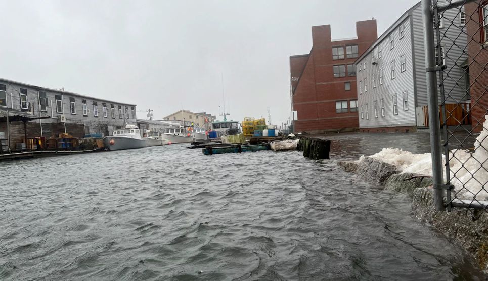
Federal oceanographer William Sweet said on a press call Tuesday that this 12-inch increase by 2050 will cause a “flood regime shift,” where storm surges are replaced by tidal flooding and the inundation already affecting many places, including in Maine, poses a more serious threat.
“The minor nuisance-like flooding that’s becoming a growing problem in many East and Gulf Coast communities and some West Coast is likely to become damaging flooding,” Sweet said. “That extra foot on average or so around the country is just going to reach further inland and go deeper and more severe.”
The East Coast, including Maine, could see between 10 and 14 inches by 2050, the report says. That’s second only to the Gulf Coast, which is projected to see 14 to 18 inches in the same time.
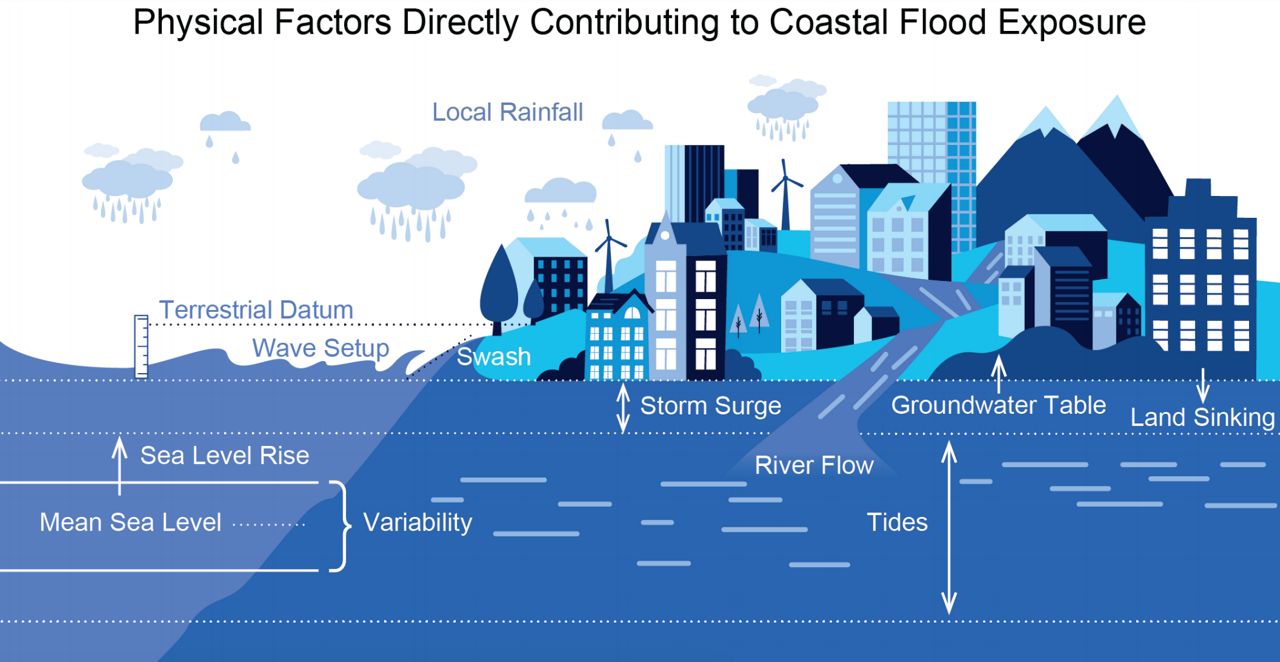
The report comes from the National Oceanic and Atmospheric Administration, with input from NASA, the Federal Emergency Management Agency and several others. It includes an update to NOAA’s sea level rise viewer, which lets users visualize and map out this data in detail.
Officials noted that large portions of U.S. residents live in close proximity to the coast, and daily necessities on which inland parts of the nation rely come through coastal ports, meaning that national efforts to curb carbon emissions are important to all residents.
“About 2 feet of sea level rise along the U.S. coastline is increasingly likely between 2020 and 2100 because of emissions to date,” NOAA says in a summary of the new report. “Failing to curb future emissions could cause an additional 1.5 (to) 5 feet of rise for a total of 3.5 (to) 7 feet by the end of this century.”
Sweet said the new projections, which include regional specifics, aim to give states and towns the best data yet to help them prepare for future, higher sea levels at the local level, such as with stormwater system upgrades and other changes to infrastructure and zoning.
“We will find a way to adapt and mitigate as we move forward,” Sweet said, “but the first part is really understanding and becoming aware of what we're actually going to be dealing with – and the maps and the datas that these groups, these inter-agency sets of folks are putting out is to do just that – so no one is taken by surprise and the planning process can begin now.”
Maine’s climate plan notes that about half of the sea level rise already on record in the state has occurred since the 1990s. The plan says communities should prepare for at least 1.5 feet of rise by 2050, and 4 to 8 feet by the end of the century, when today’s young children are in old age.
“A 1.6-foot sea-level rise may submerge 67% of Maine’s coastal sand dunes and reduce the dry beach area by 43%, which … would have significant impacts on coastal tourism,” the plan says.
Portland is already dealing with nuisance flooding through its stormwater system and in waterfront areas during the highest high tides or storm surge events. In the coming years, city planners hope to adapt to this by creating new kinds of zoning that account for climate risk.