
The cold front which brought showers and isolated thunderstorms on Tuesday morning has now cleared the coast, and high pressure is controlling the weather across North Carolina...
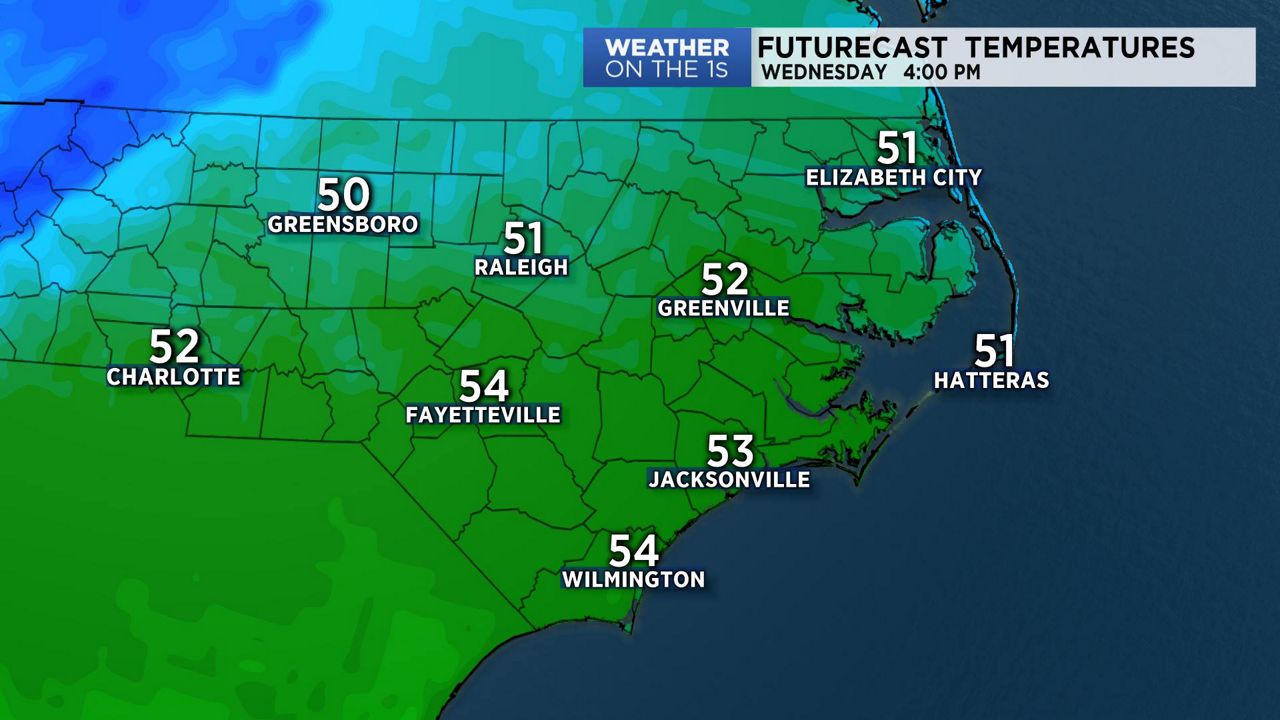
After very warm afternoon highs on Tuesday, cooler air is now building in across the state. We are calling this "a cool-down", however, after the warm temperatures of the past few days, this cool-down will give the region more normal to slightly above normal temperatures through the rest of the week.
By the weekend, most locations should see highs return to the 60s. By Sunday, a new storm system will approach North Carolina. This will give us our next chance of rain. Skies will then clear again for early next week.
Watch Spectrum News for your latest weather forecast.